Tellico Lake’s Storied Shores

Tellico Dam, Grass, and Water
Courtesy of TVA
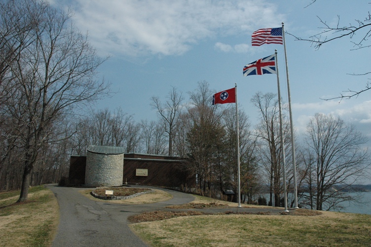
  • Tellico Lake, once known as Timberland, boasts storied shores:
    • Setting the Stage
    • Acquiring the Land
    • The Snail Darter Controversy

Tellico Lake mirrors the tranquil beauty of its neighboring communities. Yet, behind its serene facade, Tellico Lake has a fascinating history of controversy, encompassing local dynamics, government actions, environmental concerns, and intricate infrastructure developments.

Setting the Stage

architects looking at a recreation of Tellico Dam
Courtesy of the TVA

In the 1950s, local officials started planning to implement a dam along the Little Tennesee River near Lenoir City. The Fort Loudoun Dam was finished just a few years prior and had achieved noteworthy success. The original name for the project was “Timberlake,” but we know it today as Tellico Lake.

With the success of the Fort Loudoun Dam, many saw the plans for Tellico Dam as an opportunity for new jobs, better income, and economic benefit for the surrounding areas. Not only would it assist Fort Loudon in generating electric power, but also its location allows the dam to aid in flood control for the region, especially Chattanooga. In addition, Tellico Reservoir, or Tellico Lake as many now call it, would drastically change its landscape. Where there were once “fields of corn, tobacco, and hundreds of small dairy farms,” a bustling community now stood on the banks of the Little Tennesse River.

Acquiring the Land

a gavel, home, and scales
Courtesy of NCCS

To create the Tellico Lake we know today, the TVA acquired over 38,000 acres of land for development. The Tennessee Valley Authority (TVA) distributed some remaining grounds for residential, recreational, and industrial purposes as part of the proposed Timberlake planned city project. When approaching property owners, the TVA faced opposition from communities most affected by their previous projects. Still, those who were not direct beneficiaries, like the Appalachians in the Lower Tennessee Valley, were eager for the plan’s impacts.

The project’s acquisition phase involved eminent domain, allowing the TVA to take ownership of private property for public benefit. However, some property owners criticized the TVA for overreaching its authority and poorly executing relocation efforts.

Overall, the TVA spent $25.5 million on land acquisition for the Tellico Dam project. The controversy surrounding the project highlighted the tension between development plans and the preservation of local communities and their heritage.

The Snail Darter Controversy

Concerns Arise

Tellico Dam

Not the last of the hurdles, the Tellico Dam faced opposition from the TVA and environmental groups. Before any work began, the Tennessee Fish and Game Commission analyzed the situation due to fears that the dam would decimate trout fishing. Likewise, local farmers and the Cherokee Nation had concerns regarding the impact of the project and the way land was acquired.

The governor of Tennessee at this time was Winfield Dunn, who wrote a letter of dissent to the TVA in protest of the project, but the TVA was not keen to respond. Eventually, the farmers and environmental activists created the Environmental Defense Fund in 1972 and proceeded to sue the TVA via? the National Environmental Policy Act. Ultimately, these efforts would be in vain, as it was dismissed in 1972, and construction of the dam began.

Snail’s Pace to the Supreme Court

With outside pressures dealt with, the future of Tellico Dam seemed bright. That was until 1973 when a biologist and his team discovered the endangered snail darter fish. In December of the same year, the Nixon administration passed the Endangered Species Act (ESA). In turn, this legislation halted construction. 

Hill, who discovered the snail darter in the river, filed suit against the TVA, and work on the dam ceased in 1977. Later, the TVA tried to circumvent the lawsuit by petitioning for the removal of the snail darter from the endangered species list. The U.S. Fish and Wildlife Service declined this request.

Officials representing the project approached the Endangered Species Committee to exempt the dam from the ESA. It was promptly denied. Later, during a translocation of some of the snail darter population, over 100 species died, sparking further outrage. At this point, Tellico Dam, which neared completion, was dead in the water.

A Settled Debate

United States President Jimmy Carter signing a document
Courtesy of Maine Public

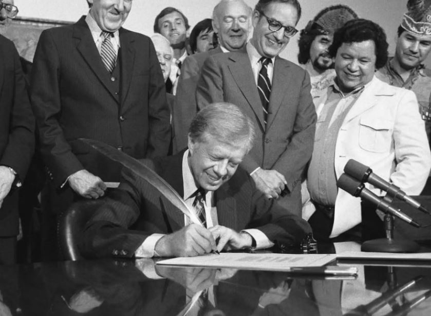
Following the upheaval caused by Tellico Dam and snail darters, further suits and arguments seemed futile. Surprisingly, President Jimmy Carter granted the Tellico reservoir project ESA exemption status in 1979. While Carter was a vocal advocate against completing the dam, continuing this stance risked American projects abroad. 

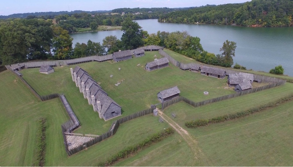
Small towns and native structures were flooded due to the dam’s impoundment, and Fort Loudoun was excavated and sits today as a state park. In an effort to ensure the species, snail darts were translocated to other rivers in the area.

Tellico Today

Courtesy of Rarity Bay

Finally, with reservations and preservation aside, the Tellico Dam project, which began in 1967, resumed impoundment 12 years later in 1979. Although Timberland would never come to fruition, prosperity still awaited the region. Today, Tellico Lake stands as a reservoir and a testament to the interplay between progress, preservation, and pristine beauty.

Frequently Asked Questions

The original name for Tellico Lake, and the community that would border it, was called Timberland.

For the completion of the Tellico Dam project, the TVA acquired over 38,000 acres in the region.

The legislation that halted the construction of Tellico Dam in 1973 was the Endangered Species Act (ESA).

The biologist who discovered snail darters in the river was a UTK biology professor named David Etnier.

In 1979, 12 years after the project began in 1967.

The History of Fort Loudoun Lake

Fort Loudoun Lake aerial shot

Fort Loudoun Lake boasts a rich and complicated history:

  • Making Landfall
  • Of Sieges and Surrenders
  • Today and Forward

Although Fort Loudoun does not lie on the lake that bears its name, their stories are inexorably intertwined. Today, we take great joy in all the opportunities the lake offers, like fishing and tubing, but the site’s calm waters were once the site of bloody battles. The history of Fort Loudoun Lake goes back centuries to the days of colonial America. The ongoing tension between the Cherokee, British, and French was a powder keg waiting to blow. 

Making Landfall

houses in a replica of Fort Loudoun
Courtesy of TN History for Kids

The British had long desired to establish fortifications in Cherokee territory, as growing French influence threatened their American colonies. They received their chance in 1755, as the Cherokee petitioned the British for assistance following raids by French-backed tribes. In October 1756, a platoon of Virginians set out to begin the construction of Fort Loudoun. The Virginians left before the South Carolinians arrived, led by Captain Raymond Demeré.

Demeré would come to be joined by John Willam Gerard de Brahm, a German engineer tasked with designing the fort. They frequently butted heads about the design, and the dispute climaxed when de Brahm returned to South Carolina. The Cherokee would come to call him “the warrior who ran away in the night.” Demeré quickly seized design control, and the fort was completed in 1757. The fort’s name was given in honor of the Earl of Loudoun, the commander of British troops at the time.

Anglo-Cherokee War

The War

Despite previous cooperation, relations between the British and Cherokee began to sour in 1758. After many miscommunications and skirmishes, the Cherokee and British became embroiled in the tides of war. Cherokee forces were known to cooperate with the colonial powers of Britain and France against one another, and this rivalry bred a new conflict: The Anglo-Cherokee War. On a patrol in 1758, Cherokee fighters enlisted by the British went on a routine mission to quell conflict with tribes allied to France, but they slaughtered colonists along the way whilst parading their spoils. The British-aligned Cherokee declared that their fallen enemies were Frenchman, but British suspicion revealed that the fallen were Brits. Attakullakulla, a leader among the Cherokee, was detained alongside some of his tribesmen by British soldiers, who eventually released them.

Unfortunately, this effort toward peace was, rightfully, ill-received. Two different Cherokee campaigns into Virginia were planned in retaliation to Attakullakulla’s treatment. Many settlers died. Attakullakulla attempted to forge peace between them regardless of his earlier detainment. Following this, there were continued skirmishes across the frontier, and relations between the Cherokee and the British declined rapidly. More of the Cherokee that once fought alongside Britain turned to the French for guns and ammunition. Oconostota, another influential Cherokee man, traveled to Virginia to sue for peace, but the governor of the territory instead took Oconostota and his men captive. Attakullakulla was able to free Oconostota and some of the men, but many were left behind. When they returned for the rest of their men, they were met with adversity by the commander of Fort Prince George. That commander was killed shortly after, but so were all his hostages.

The Surrender

While the Anglo-Cherokee War raged, things had grown quiet at Fort Loudoun. It was not until March 1760 that the Cherokee assaulted the British fortifications. The fort’s cannons kept the Cherokee at bay; the result was not a victory but a drawn-out siege. Demeré prepared for this moment and stockpiled enough food to last the garrison a few months. Later in the year, Demeré surrendered and fled to South Carolina. He would never arrive, as their party was ambushed in the night by a force of 700.

Today and Forward

Courtesy of Wikipedia

During the tumultuous Great Depression, preservationists in Tennessee began the long and arduous process of reconstructing Fort Loudoun. The Fort Loudoun Association, a group created to maintain the fortress, came to clash with the Tennessee Valley Authority in the 1960s following the proposal of the Tellico Dam. The construction of Tellico Dam would lead to the submersion of Fort Loudoun and numerous Cherokee towns, which many heavily opposed. The TVA conceded and funded a project to elevate the fort’s area above lake levels. This is why Fort Loudoun State Historic Park now sits perched atop an island in Tellico Lake. In 1965, the fort was granted National Historic Landmark status.

What once was a valley of violence sits now a tranquil lake. Fort Loudoun Lake delights visitors and residents far and wide, and its history enriches it further.

Combatants in the Anglo-Cherokee War included Britain and the Cherokee.

The English constructed Fort Loudoun with oversight from Raymon Demere and John Willam Gerard de Brahm.

The Cherokee call John Willam Gerard de Brahm “the warrior who ran away in the night” because he left the fort for Virginia.

Attakullakulla was a leader of the Cherokee who fought with and against the English.

Demere was killed by a Cherokee ambush of over 700 warriors.

Fort Loudoun State Historic Park sits on an island in Tellico Lake because the area where Tellico Lake us now was dammed and the area flooded.

Lenoir City: “Lake Capital of the South”

Downtown Lenoir City, located in Tennessee---the Lake Capital of the South.
Photo Courtesy of  Kozar Design Team 
  • Lenoir City, TN, is the “Lake Capital of the South”
    • Quick access to Lakes Tellico, Fort Loudoun, and Watts Bar
    • Stunning lake communities, such as Rarity Bay and Tellico Village
    • Excellent waterfront dining and annual lake events

Nestled in eastern Tennessee, Lenoir City showcases a bustling downtown and numerous recreational opportunities. As Joe Spence, Loudon County historian, explains, “Lenoir City originated from a 5,000-acre plot of land given to General William Lenoir by the state of North Carolina for his services in the Revolutionary War.” Over time, General Lenoir’s children and those who came after expanded the land into a thriving city. 

Joe Spence attributes Lenoir City’s rapid growth to its quick access to the railroad and river. And certainly, water has always proven instrumental in Lenoir City’s development. Today, the city contains three outstanding lakes—Tellico, Fort Loudoun, and Watts Bar. Lenoir City’s easy lake access, upscale waterfront communities, and vibrant lake-centric culture truly make it the “Lake Capital of the South.” 

Lake Access

A stunning large home on Tellico Lake in Tennessee.
Photo Courtesy of KAARMLS.com

First, Lenoir City bears the title of “Lake Capital of the South” because of its proximity to three spectacular Tennessee lakes—Tellico, Fort Loudoun, and Watts Bar. Lenoir City residents have direct access to Fort Loudoun and Tellico Lakes and only drive 20 minutes to visit Watts Bar Lake. Also, Lenoir City citizens can spend a day at nearby lakes, including  Melton, Hill, Norris, and Douglas, all within a 15 to 60-minute drive. 

Completed in 1979 by the Tennesse Valley Authority (TVA), Tellico Lake spans 15,560 acres and features 357 miles of shoreline. Locals and visitors often refer to it as “one of the cleanest lakes in Tennessee.” Moreover, with the Smoky Mountains as its magnificent backdrop, Tellico Lake boasts some of the most stunning views in the state. So if you are looking for a place to settle down or retire, Tellico Lake is ideal. 

Fort Loudoun Lake, completed by the TVA in 1943, is a nature lover’s oasis. Located in the headwaters of the Tennessee River, the lake stretches 55 miles upstream from the dam to the Holston and French Broad rivers. Fort Loudoun Lake contains 14,600 acres of pristine waters, perfect for bass fishing, boating, and birdwatching

The largest of the three Lakes, Watts Bar spans 39,000 acres and features 722 miles of shoreline, making it one of the South’s largest lakes. Created by the TVA in 1942, Watts Bar Lake is pure views, featuring rolling hills and dense forests. Also, interestingly enough, you could fit Tellico and Fort Loudoun Lakes in Watts Bar. So this is the lake for you if you want plenty of room for all your favorite recreational activities

Lake Communities

Photo Courtesy of Rarity Bay

Second, Lenoir City is the “Lake Capital of the South” because it contains many luxurious and upscale lake communities. Some of the most notable include Tellico Village, Rarity Bay, Emerald Point, Lashbrooke, Montgomery Cove, Mallard Bay, Jefferson Park, Grande Vista Bay, The Docks at Caney Creek, Rivermyst, and Lakefront Estates. Most of these communities feature resort-style living, with golf courses, marinas, restaurants, wellness centers, and more. If you long to live the laidback lake lifestyle, any of these scenic settings make an idyllic home. 

Lake Culture

Boats scattered across Watts Bar Lake at Lenoir City's Rockin' the Docks annual event.
Photo Courtesy of Visit Loudon County

Finally, Lenoir City is the “Lake Capital of the South” because the lake lifestyle permeates every aspect of the Lenoir City culture. As historian Joe Spence elucidates, whereas the river used to be Lenoir City’s lifeline, today, its lakes are its gems. Most Lenoir City residents spend their weekends at Tellico, Fort Loudoun, or Watts Bar Lakes, relaxing and engaging in recreational activities. They also enjoy dining in the city’s numerous waterfront restaurants, including hotspots such as Calhoun’s at the Marina, Tellico Village Yacht Club, and Lakeside Tavern. Additionally, annual events such as Rockin’ the Docks—pictured above—heighten the city’s affinity for its lakes. Rockin’ the Docks is a beloved local event that showcases fireworks, live music, and food and provides a snapshot of the carefree Lenoir City lake life. 

Now, you know why Lenoir City lives up to its cherished nickname. So what are you waiting for? Pack the lake toys, hook up the boat, and experience the picturesque “Lake Captial of the South” for yourself! 

Lenoir City, TN, is the “Lake Capital of the South” because it contains many luxurious and upscale lake communities. Some of the most notable include Tellico Village, Rarity Bay, Emerald Point, Lashbrooke, Montgomery Cove, Mallard Bay, Jefferson Park, Grande Vista Bay, The Docks at Caney Creek, Rivermyst, and Lakefront Estates.

Lenoir City, TN, has numerous waterfront restaurants, including hotspots such as Calhoun’s at the Marina, Tellico Village Yacht Club, and Lakeside Tavern.

Rockin’ the Docks is a beloved local event that showcases fireworks, live music, and food and provides a snapshot of the carefree Lenoir City lake life. 

Tellico Lake spans 15,560 acres and features 357 miles of shoreline.

Fort Loudoun Lake stretches 55 miles upstream from the dam to the Holston and French Broad rivers. Fort Loudoun Lake contains 14,600 acres of pristine waters, perfect for bass fishing, boating, and birdwatching.

Watts Bar spans 39,900 acres and features 722 miles of shoreline, making it one of the South’s largest lakes.